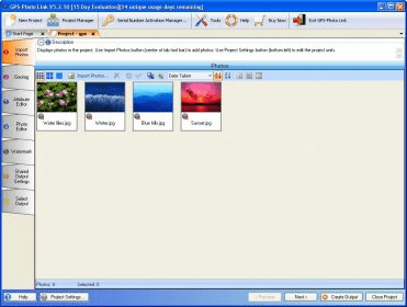
GPS-Photo Link is an photo-mapping software. It has emerged as the industry standard solution for mapping geotagged photographs and saves businesses time, money and eliminates the errors often introduced during tedious manual data entry. GPS-Photo Link enables photographers to accurately map the locations of photos taken either with a standard digital camera and hand-held GPS receiver or with a GPS camera.

Active Directory Reports Lite is the FREE edition of MaxPowerSoft's AD Reports.


Comments